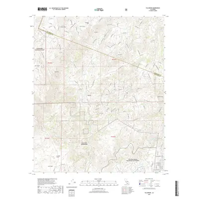
2018 Map of Fallbrook
USGS Topo · Published 2018About this map
MCB Camp Pendleton and the NWS Seal Beach Fallbrook California military installations dominate the southern half of this landscape, marking a sharp transition from the residential and agricultural canyon lands to the north. The area around De Luz is characterized by its complex network of winding mountain roads and mesa-top developments, including Redonda Mesa and Avenaloca Mesa. These high points overlook a rugged drainage system defined by De Luz Cr and Cottonwood Cr, which eventually flow toward the Santa Margarita River. Within the northwest corner, the protected terrain of the Cleveland National Forest preserves the canyons and peaks, such as Rocky Peak, near the Riverside and San Diego county line. This geography illustrates the mid-21st century balance between federal land use, military preservation, and the expansion of rural residential estates in the foothills.
Find a feature on this map
106 named features on this map. Tap any name to fly to it.
Don’t see what you’re looking for? This feature index may not catch every label — zoom into the map to look around manually.
Map Details
Editions of this 2018 Fallbrook Map
This is the sole edition of this map. No revisions or reprints were ever made.
Other maps of this area

1901 · Southern California Sheet No. 1
USGS Topo · 1:250,000

1901 · Elsinore
USGS Topo · 1:125,000

1901 · San Luis Rey
USGS Topo · 1:125,000

1904 · Southern California Sheet No. 2
USGS Topo · 1:250,000

1904 · Southern California Sheet No. 1
USGS Topo · 1:250,000

1941 · Margarita Peak
USGS Topo · 1:62,500

1942 · Lake Elsinore
USGS Topo · 1:62,500

1942 · Margarita Peak
USGS Topo · 1:62,500

1942 · Temecula
USGS Topo · 1:62,500

1942 · Murrieta
USGS Topo · 1:62,500
Featured Places
- Fallbrook, CA
- De Luz Heights, CA
- Marine Corps Base Camp Pendleton, CA
- De Luz, CA
- Santa Margarita Groves, CA