2023 Map of Falls City
USGS Topo · Published 2023About this map
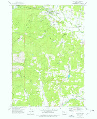
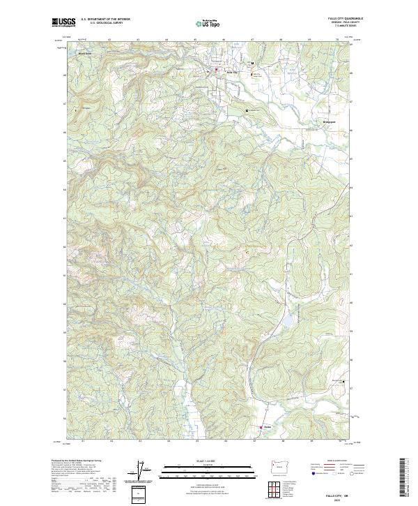
Falls City serves as the central hub of this Polk County landscape, situated where the Little Luckiamute River flows from the higher elevations of the Coast Range. The area's settlement history is evident in the cluster of local burial grounds, including the Falls City Cem, Falls City Lower Cem, and the more isolated Hubbard Cem. To the west, the former logging site of Black Rock sits near the headwaters of the river, while the eastern reaches open into the agricultural expanse of McTimmonds Valley near Bridgeport. Water resources are a defining characteristic of the region, marked by the Falls City Reservoir, Steen Reservoir, and natural features like Berry Creek Falls. The southern portion of the quadrangle transitions toward the small community of Pedee, where the drainage of Pedee Creek meets the main branch of the Luckiamute River, illustrating the complex network of creeks and forks that drain these timbered hills.
Find a feature on this map
80 named features on this map. Tap any name to fly to it.
Don’t see what you’re looking for? This feature index may not catch every label — zoom into the map to look around manually.
Map Details
Editions of this 2023 Falls City Map
This is the sole edition of this map. No revisions or reprints were ever made.