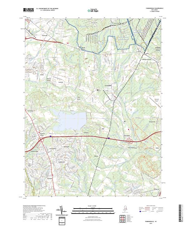
2023 Map of Farmingdale
USGS Topo · Published 2023About this map
Farmingdale serves as a central hub for this portion of Monmouth County, where modern transit corridors like 195 and Highway 9 intersect a landscape defined by an intricate network of waterways. The Manasquan River and its numerous tributaries, including Marsh Bog Brook and Mingamahone Brook, carve through the terrain, historically shaping the settlement patterns of villages such as Squankum and Ardena. This 2023 survey illustrates the dense residential growth in neighborhoods like Salem Hill, Candlewood, and Land of Pines, which now surround older crossroads such as Shacks Corner.
Find a feature on this map
234 named features on this map. Tap any name to fly to it.
Don’t see what you’re looking for? This feature index may not catch every label — zoom into the map to look around manually.
Map Details
Editions of this 2023 Farmingdale Map
This is the sole edition of this map. No revisions or reprints were ever made.
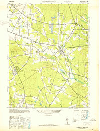
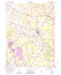
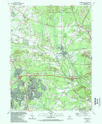
Historical Maps of Allaire Village Through Time
5 maps found