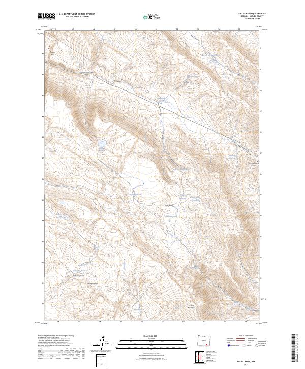
2023 Map of Fields Basin
USGS Topo · Published 2023About this map
Steens Mountain Wilderness occupies the northeastern corner of this high desert landscape, where the terrain transitions toward the Pueblo Mountains in the south. The area is defined by a sophisticated system of water management features, including Eleven Horse Reservoir, Big Basin Reservoir, and Sidehill Reservoir, which suggest a long-standing reliance on collected runoff for ranching or land management in this arid environment. Natural water sources like Bradley Lake and Antelope Lake punctuate the basin floor near the towering Catlow Rim.
Find a feature on this map
46 named features on this map. Tap any name to fly to it.
Don’t see what you’re looking for? This feature index may not catch every label — zoom into the map to look around manually.
Map Details
Editions of this 2023 Fields Basin Map
This is the sole edition of this map. No revisions or reprints were ever made.
Other maps of this area

1955 · Adel
USGS Topo · 1:250,000

1957 · Adel
USGS Topo · 1:250,000

1958 · Adel
USGS Topo · 1:250,000

1962 · Adel
USGS Topo · 1:250,000

1971 · Square Mountain
USGS Topo · 1:24,000

1971 · Fields Basin
USGS Topo · 1:24,000

1971 · Garrison Lake
USGS Topo · 1:24,000

1971 · V Lake
USGS Topo · 1:24,000

1971 · Fields
USGS Topo · 1:24,000
1971 · Skull Creek Butte
USGS Topo · 1:24,000