2024 Map of Findlay
USGS Topo · Published 2024About this map
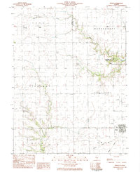
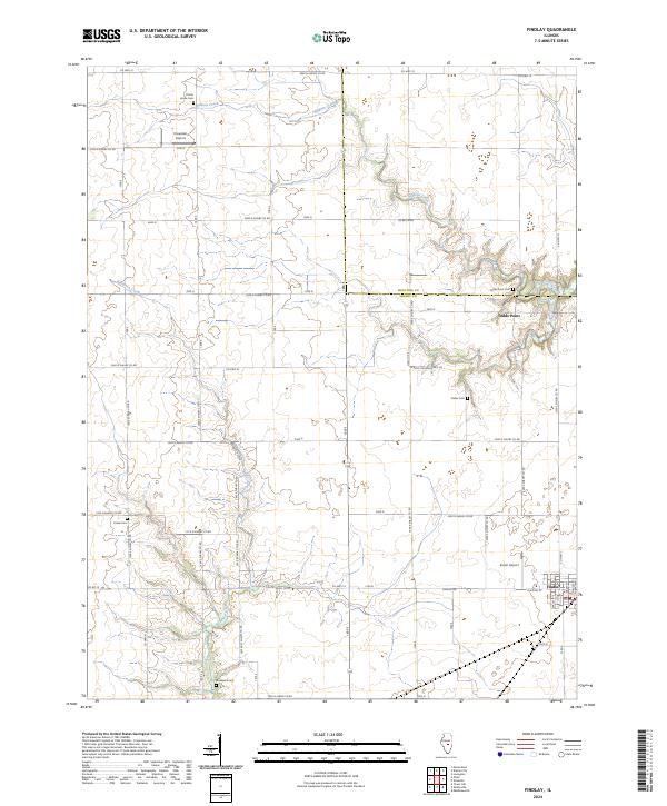
Findlay occupies the southeastern corner of this central Illinois landscape, where the grid of county roads meets the winding courses of Robinson Creek and Wilborn Creek. The area is defined by its agrarian roots and family history, evidenced by a high density of rural burial grounds such as Prairie Home Cem, Foster Cem, and Union Cem. The terrain shifts from flat till plain to more dissected land around Todds Point, a prominent topographic feature near the Moultrie and Shelby county line. The presence of private airfields like Kroenlein Airport and Enoch Airport suggests a modern continuation of the region's long-standing connection between transportation and agriculture. This map provides a detailed view of the rural infrastructure, including Findlay Rd and numerous Shelby County roads that organize the township sections.
Find a feature on this map
40 named features on this map. Tap any name to fly to it.
Don’t see what you’re looking for? This feature index may not catch every label — zoom into the map to look around manually.
Map Details
Editions of this 2024 Findlay Map
This is the sole edition of this map. No revisions or reprints were ever made.