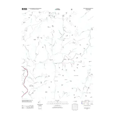
2013 Map of Fines Creek
USGS Topo · Published 2013About this map
Fines Creek and the surrounding Haywood County landscape appear here in detail, defined by a complex network of high ridges and narrow coves. The settlement at Cove sits at the junction of Cove Cr and James Br, illustrating how early habitation followed the primary water sources in this vertical environment. High-elevation landmarks like Hurricane Ridge and Snake Den Ridge frame the drainage basins, while lower elevations are marked by the Pigeon River and the waters of Waterville Lake near the western edge. Notable family and place names are preserved in features such as Black Bear Cv and Liner Cove. The map tracks the winding paths of local routes like Poplar Cove Rd and Earl Bradley Rd, which provide access to high points like Crabtree Bald and Ferguson Mountain.
Find a feature on this map
162 named features on this map. Tap any name to fly to it.
Don’t see what you’re looking for? This feature index may not catch every label — zoom into the map to look around manually.
Map Details
Editions of this 2013 Fines Creek Map
This is the sole edition of this map. No revisions or reprints were ever made.
Other maps of this area

1893 · Mt Guyot
USGS Topo · 1:125,000

1894 · Asheville
USGS Topo · 1:125,000

1901 · Asheville
USGS Topo · 1:125,000

1912 · Mt Guyot
USGS Topo · 1:125,000

1935 · Newport
USGS Topo · 1:48,000

1935 · Canton
USGS Topo · 1:24,000

1935 · Dellwood
USGS Topo · 1:24,000

1935 · Clyde
USGS Topo · 1:24,000

1935 · Spring Creek
USGS Topo · 1:24,000

1935 · Lemon Gap
USGS Topo · 1:24,000