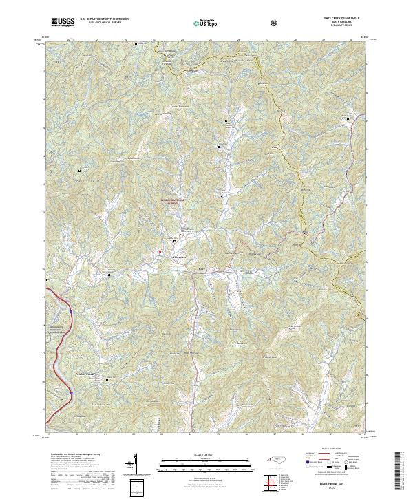
2022 Map of Fines Creek
USGS Topo · Published 2022About this map
The mountain settlement of Fines Creek and its surrounding coves define this landscape within the Pisgah National Forest. This modern survey details a complex network of family-named cemeteries and landmarks that speak to generations of residency in the high country, including the Robert Newton Rogers Cem, Thad Rogers Cem, and Haynes Cem. The geography is shaped by prominent gaps and ridges such as Hurricane Gap and Fines Creek Gap, which dictate the local road patterns along Spring Creek and the Bald Fork. Religious life is anchored by established congregations such as the Fines Creek Memorial Baptist Church Cem and the Panther Creek Baptist Church Cem. Near the western edge, the map touches the Great Smoky Mountains National Park, where the terrain ascends toward Hurricane Ridge and Hurricane Mtn.
Find a feature on this map
156 named features on this map. Tap any name to fly to it.
Don’t see what you’re looking for? This feature index may not catch every label — zoom into the map to look around manually.
Map Details
Editions of this 2022 Fines Creek Map
This is the sole edition of this map. No revisions or reprints were ever made.
Other maps of this area

1893 · Mt Guyot
USGS Topo · 1:125,000

1894 · Asheville
USGS Topo · 1:125,000

1901 · Asheville
USGS Topo · 1:125,000

1912 · Mt Guyot
USGS Topo · 1:125,000

1935 · Newport
USGS Topo · 1:48,000

1935 · Canton
USGS Topo · 1:24,000

1935 · Dellwood
USGS Topo · 1:24,000

1935 · Clyde
USGS Topo · 1:24,000

1935 · Spring Creek
USGS Topo · 1:24,000

1935 · Lemon Gap
USGS Topo · 1:24,000