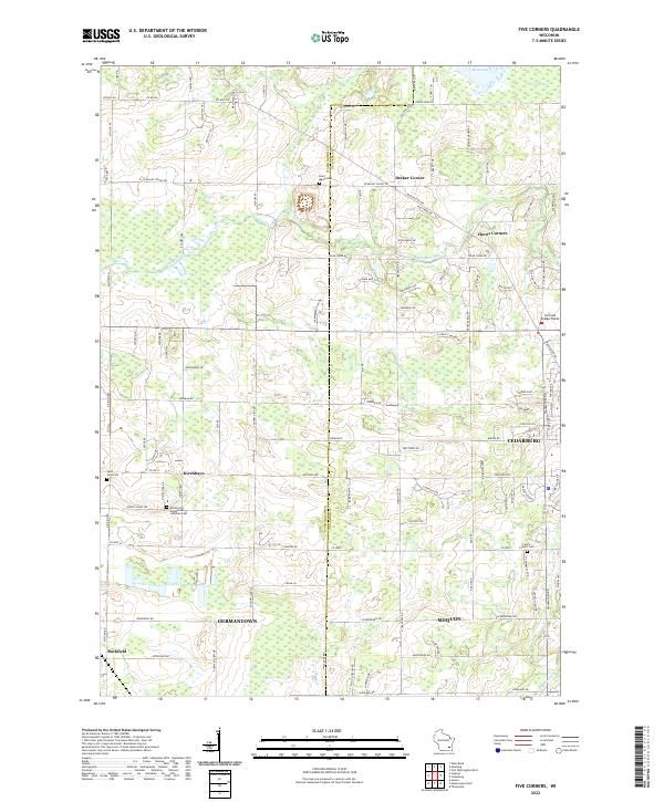
2022 Map of Five Corners
USGS Topo · Published 2022About this map
Kirchhayn and Decker Corner stand at the intersection of a landscape defined by rolling agricultural fields and significant glacial wetlands. The eastern edge is dominated by the sprawling Cedarburg Bog, a critical ecological feature just north of the growing municipal boundaries of Cedarburg and Mequon. This modern survey illustrates the persistent rural character of the Washington County and Ozaukee County line, where family-named landmarks like Horns Corners and small hamlets like Rockfield remain distinct against the encroaching suburban grid from Germantown. Cultural history is anchored by several long-standing religious sites, including the Davids Star Evangelical Lutheran Cem and Saint John Cem, which serve as genealogical touchstones for the area's early German settlers. The course of Cedar Creek winds through the center, passing near the Covered Bridge Fields, marking the transition from protected natural space to cultivated farmland.
Find a feature on this map
107 named features on this map. Tap any name to fly to it.
Don’t see what you’re looking for? This feature index may not catch every label — zoom into the map to look around manually.
Map Details
Editions of this 2022 Five Corners Map
This is the sole edition of this map. No revisions or reprints were ever made.
Historical Maps of Jackson Through Time
4 maps found