2022 Map of Flora
USGS Topo · Published 2022About this map
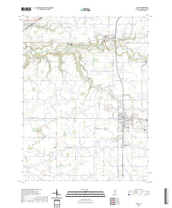
Flora and Camden anchor this central Carroll County landscape, where a dense grid of rural roads connects well-established agricultural lands. The terrain is defined by the winding course of Deer Creek in the north and the reaches of Sugar Cr to the south, with numerous named drainage features like Bachelor Run and Ayres Ditch supporting the region's productive fields. Family history and local heritage are deeply embedded in the land, marked by numerous burial grounds including Sharp Point Cem, Wise Cem, and the Musselman Cem. In the southeastern portion, the small settlement of Bringhurst sits just south of the town center of Flora, near the Flora Municipal Airport. This modern survey reflects the enduring spatial organization of Indiana’s heartland, where historical cemeteries such as Maple Lawn Cem and Nettle Cem remain as physical anchors amidst a landscape of evolving transportation and drainage networks.
Find a feature on this map
67 named features on this map. Tap any name to fly to it.
Don’t see what you’re looking for? This feature index may not catch every label — zoom into the map to look around manually.
Map Details
Editions of this 2022 Flora Map
This is the sole edition of this map. No revisions or reprints were ever made.