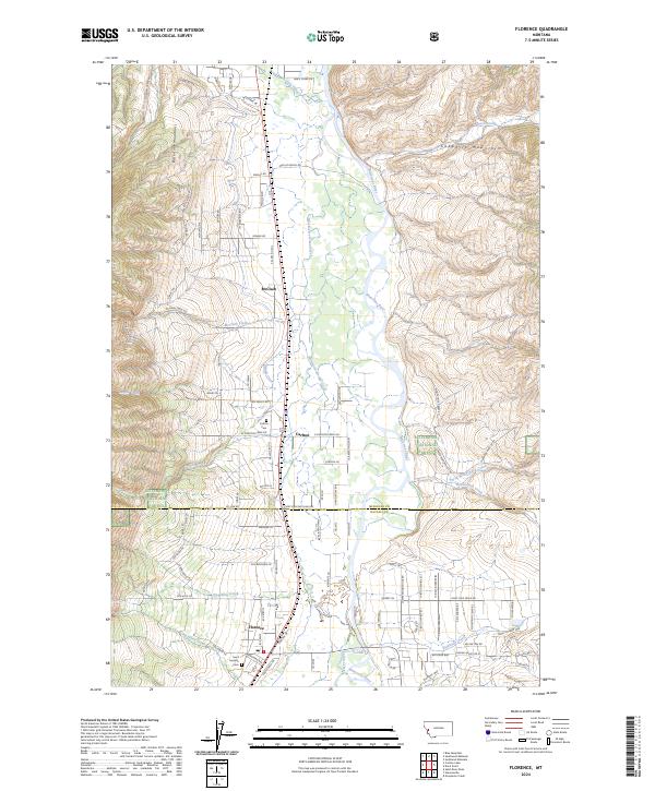
2024 Map of Florence
USGS Topo · Published 2024About this map
The Bitterroot River valley floor transitions between the high peaks of the Bitterroot Mountains to the west and the Sapphire Mountains to the east, defining the geography of this modern landscape. The settlement of Florence serves as the primary hub in this portion of Ravalli County, situated where the valley widens to accommodate a network of rural homesteads and agricultural tracts. Further north, the smaller communities of Carlton and McClain sit along the corridor of Old US Hwy 93, a route closely following the river's path. Local history is anchored by sites like Carlton Cem and Saint Josephs Cem, providing touchpoints for genealogical research in the area. The map also captures the lower reaches of numerous drainages such as McClain Creek and Smit-tin-em-ska-Creek, while the western hills are largely comprised of the Bitterroot National Forest.
Find a feature on this map
109 named features on this map. Tap any name to fly to it.
Don’t see what you’re looking for? This feature index may not catch every label — zoom into the map to look around manually.
Map Details
Editions of this 2024 Florence Map
This is the sole edition of this map. No revisions or reprints were ever made.
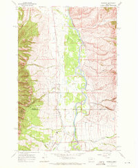
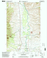
Historical Maps of McClain Through Time
3 maps found