Old Maps of Missoula County, Montana
Explore 573 old maps of Missoula County, spanning from 1902 to today. These high-resolution historic maps reveal how streets, neighborhoods, landmarks, and natural features evolved over time — perfect for genealogy, metal detecting, research, and local history exploration.
What you can do with these maps:
- See how Missoula County changed over time: Compare historical maps to modern-day views to trace roads, homesites, rail lines & more.
- View detailed metadata: Each map includes creators, publishers, year, scale, and archive source.
- Overlay maps with satellite & LiDAR: Visualize the past alongside modern tools to explore terrain & human change.
- Trusted historical sources: Maps sourced from the USGS, Library of Congress, and other archives.
- Access maps your way: View online, download high-res files, or order prints for personal or research use.
Start exploring old maps of Missoula County to uncover forgotten places, hidden landmarks, and the deep history beneath your feet.
Missoula County, MT maps
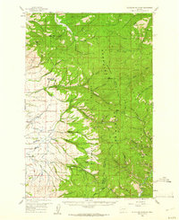
(573)- 1902 Map of Ovando, 1960 Print
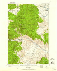
 1902 Ovando1960 Print · USGSMontana's mountain ranchlands come into focus at the turn of the century, centered on the valley around Ovando. Genealogists and historians can trace numerous family homesteads and early outposts, including Danaher's Ranch, Woodworth, and Blanchard's Ranch.2 unique versions available
 - 1903 Map of Bonner
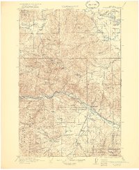
 1903 Bonner1903 Print · USGSMissoula and the surrounding river canyons come to life in this turn-of-the-century survey during the height of early rail expansion. Trace the original path of the Northern Pacific through mountain passes and locate early settlements like Bonner, Potomac, and Clinton.4 unique versions available
 - 1905 Map of Ovando
 1905 Ovando1905 Print · USGSThe Montana backcountry at the turn of the century is a landscape of isolated homesteads and forest reserves. Researchers can locate early family-owned landmarks like Danaher's Ranch and Jakway's Ranch or trace the early timber works at Logging Camp.2 unique versions available
 - 1911 Map of Lolo, 1954 Print
 1911 Lolo1954 Print · USGSThe Bitterroot wilderness at the dawn of the Forest Service era is documented here through its early camps and trail networks. Researchers can locate remote outposts like Moose City, the Clearwater Gold and Copper Company, and the historic Indian Post Office landmark.
 - 1912 Map of Missoula
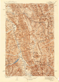
 1912 Missoula1912 Print · USGSWestern Montana at the end of the frontier era shows a landscape of growing rail hubs and remote mountain outposts. Researchers can trace early river crossings like Alberts Ferry, the grounds of Ft Missoula, and vanished schools such as Big Flat School.4 unique versions available
 - 1913 Map of Lolo
 1913 Lolo1913 Print · USGSThe Bitterroot wilderness of the early 1900s is documented here through a web of mining camps, ranger stations, and high mountain passes. Genealogists and researchers can locate remote sites like Moose City, Williams Ranch, and the Clearwater Gold and Copper Company.2 unique versions available
 - 1919 Map of Drummond, 1958 Print
 1919 Drummond1958 Print · USGSGranite and Powell counties were at the height of their rail-and-ranching era in the years following the Great War. Researchers can trace the dual paths of the Northern Pacific railroad through Drummond or locate long-standing landmarks like New Chicago and the Sugarloaf School.2 unique versions available
 - 1921 Map of Drummond
 1921 Drummond1921 Print · USGSGranite and Missoula counties are seen here in the years following the Great War, as mining camps and valley ranches defined the local economy. Genealogists can trace family homesteads like Williams Ranch or locate rural landmarks including Sunset School and Garnet.3 unique versions available
 - 1921 Map of Elbow Lake
 1921 Elbow Lake1921 Print · USGSThe Montana wilderness near Missoula is captured here during the early 1920s, showcasing the transition of the former reservation lands. Genealogists and hikers can trace early routes like the Gordon Trail and locate historical landmarks such as Gordon Ranch and Holland Lake R.S.
 - 1936 Map of Silvertip
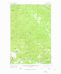
 1936 Silvertip1936 Print · USGSThe Flathead National Forest wilderness in the mid-1930s was a land of isolated outposts and early aviation. Researchers can trace the early ranger station network at Spotted Bear Ranger Sta and remote landmarks like Indian Camp or Limestone Cabin.3 unique versions available
 - 1942 Map of Silvertip
 1942 Silvertip1942 Print · USGSThe South Fork of the Flathead River backcountry is captured here in the late thirties, showing a wilderness managed by air and trail. Locate historic outposts like Big Prairie Ranger Sta, early airstrips, and remote cabins such as Limestone Cabin.2 unique versions available
 - 1947 Map of Butte, 1949 Print
 1947 Butte1949 Print · USGSWestern Montana at the peak of its rail-and-river era shows the vital connections between the mining and industrial centers of Butte and Helena. Researchers can trace the three major railroad lines serving mountain settlements like Garrison, Philipsburg, and Warm Springs.2 unique versions available
 - 1955 Map of Choteau, 1978 Print
 1955 Choteau1978 Print · USGSWestern Montana during the mid-fifties is captured here as a land of rugged high-country wilderness and vital eastern plains irrigation. Genealogists and historians can locate remote outposts like Condon, the communal Miller Colony, and the rail stops of the Chicago Milwaukee St Paul and Pacific.
 - 1956 Map of Wallace, 1966 Print
 1956 Wallace1966 Print · USGSWestern Montana and the Idaho panhandle meet in this mid-century survey of the Bitterroot and Cabinet Mountains. Genealogists and historians can trace the rail-and-river economy through the Northern Pacific line and settlements like Thompson Falls or St. Ignatius.3 unique versions available
 - 1956 Map of Hamilton, 1970 Print
 1956 Hamilton1970 Print · USGSThe Bitterroot Valley and surrounding high country are captured here during the mid-fifties, showing the region's transition into a modern forest-and-rail hub. Genealogists and historians can trace family-named sites and early infrastructure from Fort Missoula to towns like Stevensville and Darby along the Northern Pacific line.2 unique versions available
 - 1957 Map of Choteau
 1957 Choteau1957 Print · USGSMontana's mountain front meets the eastern plains in the mid-fifties, showing the transition from forested wilderness to irrigated ranch land. Genealogists and historians can trace the rail lines of the Great Northern and find settlements like Choteau, Augusta, and Seeley Lake.
 - 1958 Map of Butte
 1958 Butte1958 Print · USGSWestern Montana's mining and rail corridors are captured in the late fifties, from the urban bustle of the Copper King cities to high mountain passes. Researchers can trace the path of the Milwaukee St Paul and Pacific through Deer Lodge and locate remote outposts like Potomac Post Office.5 unique versions available
 - 1958 Map of Choteau
 1958 Choteau1958 Print · USGSMontana's front range meets the high wilderness in the late fifties, where the Great Northern railway connects ranching towns to the eastern plains. Researchers can trace the development of irrigation at Bynum Reservoir or locate remote camps like the Big Prairie District Ranger Station and Helmville.2 unique versions available
 - 1959 Map of Hamilton
 1959 Hamilton1959 Print · USGSThe Bitterroot Valley and surrounding wilderness are captured in the late fifties, showing a landscape defined by forestry and river-based settlement. Researchers can trace the Lolo Trail or locate historical points like Fort Missoula and the Fred Burr Reservoir.
 - 1959 Map of Tarkio, 1961 Print
 1959 Tarkio1961 Print · USGSMineral County's river-and-rail corridor is captured here in the late fifties, during the peak era of the transcontinental railroads. Researchers can trace the heritage of small trackside communities like Tarkio and Rivulet or locate specific historical sites such as the local cemetery and mines.3 unique versions available
 - 1959 Map of Cleveland Mountain, 1961 Print
 1959 Cleveland Mountain1961 Print · USGSRavalli and Missoula counties meet along the high ridges of the Sapphire Mountains during the late fifties. Genealogists and historians can locate the Ambrose settlement, trace early timber and mining routes like Woodchuck, or find the Lone Rock Sch near the river.2 unique versions available
 - 1959 Map of Bearmouth, 1961 Print
 1959 Bearmouth1961 Print · USGSGranite County in the late fifties shows a landscape defined by the deep canyons of the Clark Fork and high mountain ridges. Researchers can trace historic transportation routes like the Mullan Road and find remote sites such as Griffith Cabin and the Conn Ranch.3 unique versions available
 - 1959 Map of Alberton, 1961 Print
 1959 Alberton1961 Print · USGSAs the mid-century timber and rail economies peaked, this area of western Montana balanced remote wilderness with vital transport lines. Genealogists and historians can trace the Northern Pacific rail line and local landmarks like the Favorite Mine and the Ninemile Community Hall.2 unique versions available
 - 1959 Map of Arlee, 1961 Print
 1959 Arlee1961 Print · USGSThe Flathead Indian Reservation and Jocko River valley are shown here in the late fifties, during a period of established ranching and rail activity. Genealogists and historians can locate family landmarks like Nielson Ranch, the Mission Ch, and the Frenchtown Cem.3 unique versions available
 - 1959 Map of Ravenna, 1961 Print
 1959 Ravenna1961 Print · USGSIn the late 1950s, this mountainous border between Missoula and Granite Counties was a hub of river-and-rail transport. Researchers can trace the dual tracks of the Northern Pacific and Milwaukee Road, locating vanished stops like Nimrod and the old settlement at Quigley.2 unique versions available
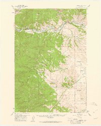
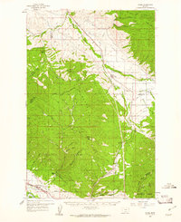
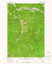
Showing maps 1-25 of 573
Top cities of Missoula County
Frequently asked questions
- What are the different types of historical maps available for Missoula County?
- What is the oldest map of Missoula County?
- Where can I purchase historical maps of Missoula County for my home or office?
- Where can I download high-res historical maps of Missoula County?
- Are there historical topographic maps available for Missoula County?
- Is there historical aerial imagery available for Missoula County?
- Where are historical maps of Missoula County sourced from?