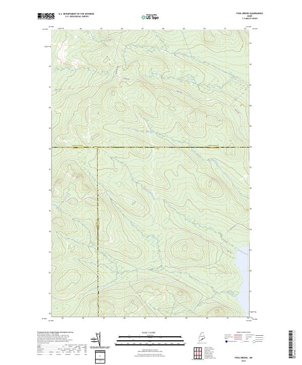
2024 Map of Fool Brook
USGS Topo · Published 2024About this map
The remote northern Maine wilderness, where the borders of Aroostook, Somerset, and Piscataquis counties converge, is defined by a dense network of watercourses and logging routes. Centered on Fool Brook, this landscape is shaped by the drainage patterns of Sweeney Brook and Mills Brook, which flow through the forested uplands. The absence of traditional settlements is replaced by a functional geography of timber management, with transit corridors like Realty Rd, Boulevard Rd, and Poulin Rd providing the only terrestrial access through the deep woods. Topographic details illustrate the complex terrain surrounding Center Brook in the northern reaches, while Ross Mt Rd and Rds 7 Rd serve the southeastern sector near the water's edge. This map documents a modern era of industrial forestry in a region where geography is defined by the intersection of county lines and watershed boundaries.
Find a feature on this map
12 named features on this map. Tap any name to fly to it.
Don’t see what you’re looking for? This feature index may not catch every label — zoom into the map to look around manually.
Map Details
Editions of this 2024 Fool Brook Map
This is the sole edition of this map. No revisions or reprints were ever made.
Other maps of this area

1954 · Baker Lake
USGS Topo · 1:62,500

1954 · Allagash Lake
USGS Topo · 1:62,500

1954 · Presque Isle
USGS Topo · 1:250,000

1955 · Beaver Pond
USGS Topo · 1:62,500

1955 · Clayton Lake
USGS Topo · 1:62,500

1958 · Presque Isle
USGS Topo · 1:250,000

1960 · Presque Isle
USGS Topo · 1:250,000

1961 · Allagash Lake
USGS Topo · 1:62,500

1962 · Baker Lake
USGS Topo · 1:62,500
1986 · Mary L Pond
USGS Topo · 1:24,000