2021 Map of Forestburg
USGS Topo · Published 2021About this map
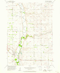
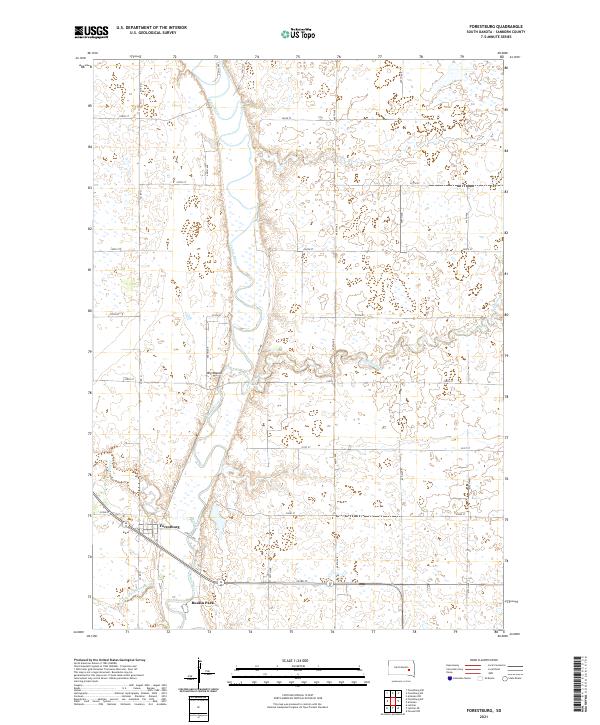
James River meanders south through this section of Sanborn County, anchoring a landscape shaped by both natural drainage and early water management efforts. The settlement of Forestburg sits near the intersection of several local routes, including Co Rd 21 and Corliss Ave, while further south lies the community of Ruskin Park. The terrain is punctuated by Big Mound, a distinct topographic rise that stands apart from the river valley. To the west, the flow of Sand Cr joins the larger river system, while the southern end of the sheet shows evidence of agricultural engineering through County Ditch Number 14. This map reveals a contemporary look at the rural section lines and township boundaries of the Dakota prairie, where tributary waters like Redstone Cr wind through the eastern townships.
Find a feature on this map
29 named features on this map. Tap any name to fly to it.
Don’t see what you’re looking for? This feature index may not catch every label — zoom into the map to look around manually.
Map Details
Editions of this 2021 Forestburg Map
This is the sole edition of this map. No revisions or reprints were ever made.