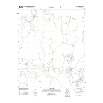
2011 Map of Fort Bayard
USGS Topo · Published 2011About this map
The Pinos Altos Historic District anchors the northern reaches of this territory, where the legacy of early mining is etched into the landscape near Pinos Altos Mountain. A dense concentration of mining claims including the Mountain Key Mine, Pacific Mine, and Manhattan Mine surround the settlement, illustrating the mineral-driven development of the late 19th and early 20th centuries. Further south, the map reveals the transition from these upland mining districts to the residential and institutional corridors of Santa Clara and Fort Bayard.
Find a feature on this map
79 named features on this map. Tap any name to fly to it.
Don’t see what you’re looking for? This feature index may not catch every label — zoom into the map to look around manually.
Map Details
Editions of this 2011 Fort Bayard Map
This is the sole edition of this map. No revisions or reprints were ever made.
Other maps of this area

1909 · Silver City
USGS Topo · 1:125,000

1937 · Santa Rita
USGS Topo · 1:24,000

1947 · Allie Canyon
USGS Topo · 1:24,000

1947 · Twin Sisters
USGS Topo · 1:24,000

1947 · Fort Bayard
USGS Topo · 1:24,000

1948 · Twin Sisters
USGS Topo · 1:24,000

1948 · Santa Rita
USGS Topo · 1:24,000

1948 · Allie Canyon
USGS Topo · 1:24,000

1948 · Hurley East
USGS Topo · 1:24,000

1949 · Fort Bayard
USGS Topo · 1:24,000