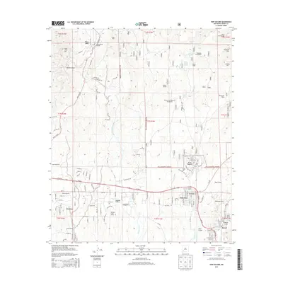
2013 Map of Fort Bayard
USGS Topo · Published 2013About this map
The Continental Divide winds through the high-elevation terrain of the Gila National Forest, defining the northern reaches of this New Mexico landscape. Mining and settlement history converge near Pinos Altos, while the southern corridor follows the path of Us-180 through a series of communities including Santa Clara, Arenas Valley, and Bayard. The historic medical and military presence in the region is anchored by Fort Bayard and the nearby Ft Bayard National Cemetery, situated along the drainages of Cameron Creek. Between the steep elevations of Pinos Altos Mountain and the residential blocks of Rosedale, the land is marked by numerous peaks like Castle Knob and water sources such as Fort Bayard Hospital Springs. Small-scale aviation is represented by the Whiskey Creek Airport, serving this transition point between the mountains and the valley plains.
Find a feature on this map
158 named features on this map. Tap any name to fly to it.
Don’t see what you’re looking for? This feature index may not catch every label — zoom into the map to look around manually.
Map Details
Editions of this 2013 Fort Bayard Map
This is the sole edition of this map. No revisions or reprints were ever made.
Other maps of this area

1909 · Silver City
USGS Topo · 1:125,000

1937 · Santa Rita
USGS Topo · 1:24,000

1947 · Allie Canyon
USGS Topo · 1:24,000

1947 · Twin Sisters
USGS Topo · 1:24,000

1947 · Fort Bayard
USGS Topo · 1:24,000

1948 · Twin Sisters
USGS Topo · 1:24,000

1948 · Santa Rita
USGS Topo · 1:24,000

1948 · Allie Canyon
USGS Topo · 1:24,000

1948 · Hurley East
USGS Topo · 1:24,000

1949 · Fort Bayard
USGS Topo · 1:24,000