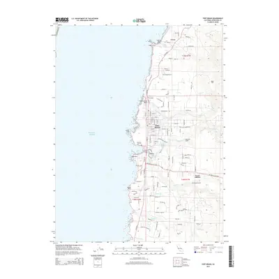
2015 Map of Fort Bragg
USGS Topo · Published 2015About this map
The coastal city of Fort Bragg sits at the heart of this survey, showing a well-defined grid of residential and commercial streets south of Pudding Creek. The industrial and maritime legacy of the Mendocino coast is evident at Noyo, where the Noyo River meets the Pacific Ocean at Noyo Bay. This area includes the Noyo Basin and the Noyo River Cemetery, which serves as a significant landmark for genealogical research. To the north, the smaller settlement of Cleone is situated near Lake Cleone and the coastal features of Laguna Point. The landscape is defined by several drainage systems, including Hare Creek and Virgin Creek, which cut through the terrain toward the rocky shoreline. Notable infrastructure includes the Fort Bragg Airport and the expansion of the Heeser Addition, providing a clear view of the mid-20th-century footprint of this lumber and fishing hub.
Find a feature on this map
117 named features on this map. Tap any name to fly to it.
Don’t see what you’re looking for? This feature index may not catch every label — zoom into the map to look around manually.
Map Details
Editions of this 2015 Fort Bragg Map
This is the sole edition of this map. No revisions or reprints were ever made.
Other maps of this area

1920 · Glenblair
USGS Topo · 1:62,500

1920 · Fort Bragg
USGS Topo · 1:62,500

1921 · Westport
USGS Topo · 1:62,500

1921 · Branscomb
USGS Topo · 1:62,500

1943 · Glenblair
USGS Topo · 1:62,500

1943 · Fort Bragg
USGS Topo · 1:62,500

1950 · Cape Vizcaino
USGS Topo · 1:62,500

1951 · Cape Vizcaino
USGS Topo · 1:62,500

1951 · Branscomb
USGS Topo · 1:62,500

1957 · Ukiah
USGS Topo · 1:250,000