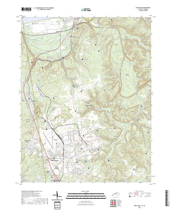
2022 Map of Fort Knox
USGS Topo · Published 2022About this map
The massive military installation at Fort Knox anchors this area where the Salt River joins the Ohio River. The map reveals the intricate infrastructure of the base, from Godman Army Airfield to residential areas like Gaffey Heights and Prichard Place. For genealogists, the landscape is densely populated with historical burial grounds, including the Fort Knox Post Cem and dozens of family-named sites such as Geoghegan Cem and Harris-Hawkins Cem. North of the post, the town of West Point sits at the confluence, while the terrain to the east rises into high points like McClelland Ridge and Hooker Mtn. The transport network of the mid-2020s is well-defined, showing the Louisville Nashville Tpke and several old turnpikes cutting through the hills, providing a clear view of how military and civilian landscapes have integrated over decades.
Find a feature on this map
176 named features on this map. Tap any name to fly to it.
Don’t see what you’re looking for? This feature index may not catch every label — zoom into the map to look around manually.
Map Details
Editions of this 2022 Fort Knox Map
This is the sole edition of this map. No revisions or reprints were ever made.
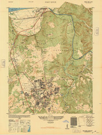
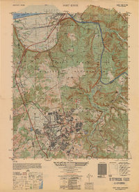
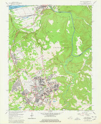
Historical Maps of Muldraugh Through Time
5 maps found