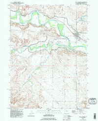
1990 Map of Fort Laramie
USGS Topo · Published 1995About this map
The Fort Laramie National Historic Site anchors this 1990 revision, preserving the grounds of one of the 19th-century West's most significant military and trading posts. Located at the confluence where the Laramie River meets the North Platte River, the map captures the transition from historic frontier fortification to a modern landscape of irrigation and resource management. The intricate network of ditches, siphons, and levees along the riverbanks illustrates the engineering required to sustain agriculture in the arid plains.
Find a feature on this map
17 named features on this map. Tap any name to fly to it.
Don’t see what you’re looking for? This feature index may not catch every label — zoom into the map to look around manually.
Map Details
Editions of this 1990 Fort Laramie Map
This is the sole edition of this map. No revisions or reprints were ever made.
Other maps of this area

1896 · Patrick
USGS Topo · 1:125,000

1896 · Hartville
USGS Topo · 1:125,000

1901 · Hartville
USGS Topo · 1:125,000

1950 · Rockeagle
USGS Topo · 1:24,000

1950 · Guernsey
USGS Topo · 1:24,000

1950 · Casebier Hill
USGS Topo · 1:24,000

1950 · Fort Laramie
USGS Topo · 1:24,000

1950 · Register Cliff
USGS Topo · 1:24,000

1951 · Eagles Nest
USGS Topo · 1:24,000

1952 · Register Cliff
USGS Topo · 1:24,000