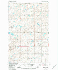
1983 Map of Fortuna
USGS Topo · Published 1984About this map
Fortuna anchors this northern Divide County landscape during the early 1980s, positioned just south of the Canada United States border. The settlement's role as a regional agricultural hub is evidenced by the Grain Elevator and multiple Storage Bins clustered along the Soo Line tracks. To the west, the Fortuna Air Force Station represents a significant military presence in this rural prairie environment. The terrain is marked by numerous prairie potholes and intermittent water features, including a Flowing Well in Clinton township and various springs. Township boundaries such as Dewitt, Elkhorn, and Westby define the legal geography of the area, while industrial activity is noted by several Gravel Pit locations, reflecting the local extraction economy of the high plains.
Find a feature on this map
22 named features on this map. Tap any name to fly to it.
Don’t see what you’re looking for? This feature index may not catch every label — zoom into the map to look around manually.
Map Details
Editions of this 1983 Fortuna Map
This is the sole edition of this map. No revisions or reprints were ever made.
Other maps of this area

1953 · Williston
USGS Topo · 1:250,000

1957 · Williston
USGS Topo · 1:250,000

1983 · Colgan West
USGS Topo · 1:24,000

1983 · Writing Rock North
USGS Topo · 1:24,000

1983 · Alkabo
USGS Topo · 1:24,000

1983 · Alexandria
USGS Topo · 1:24,000
1983 · Skjermo Lake
USGS Topo · 1:24,000

1984 · Crosby
USGS Topo · 1:100,000
2011 · Writing Rock North
USGS Topo · 1:24,000
2011 · Alkabo
USGS Topo · 1:24,000