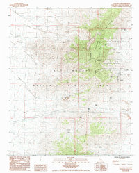
1985 Map of Fountain Peak
USGS Topo · Published 1985About this map
The Providence Mountains dominate this high-desert landscape in the mid-1980s, serving as a hub for both resource extraction and conservation within the East Mojave National Scenic Area. Mining activity is extensively documented across the slopes, from the Rex Mine and Bonanza King Mine in the north to the Vulcan Mine situated near the Winston Basin. This era represents a period of recreational transition, as the Providence Mountains State Recreation Area and Mitchell Caverns State Natural Preserve protected subterranean landmarks like Mitchell Caverns and Winding Stair Cave. A network of water sources, including Cornfield Spring and Foshay Spring, provided critical points of survival and industry in an arid terrain marked by the Vulcan Mine Road and various pipelines. High peaks such as Edgar Peak and Fountain Peak overlook the deep cuts of Gilroy Canyon, illustrating the topographical challenges faced by 20th-century surveyors and miners.
Find a feature on this map
30 named features on this map. Tap any name to fly to it.
Don’t see what you’re looking for? This feature index may not catch every label — zoom into the map to look around manually.
Map Details
Editions of this 1985 Fountain Peak Map
This is the sole edition of this map. No revisions or reprints were ever made.
Other maps of this area

1910 · Ivanpah
USGS Topo · 1:250,000

1912 · Ivanpah
USGS Topo · 1:250,000

1942 · Ivanpah
USGS Topo · 1:250,000

1942 · Amboy
USGS Topo · 1:250,000

1943 · Amboy
USGS Topo · 1:250,000

1947 · Kingman
USGS Topo · 1:250,000

1948 · Kingman
USGS Topo · 1:250,000

1954 · Needles
USGS Topo · 1:250,000

1954 · Kingman
USGS Topo · 1:250,000

1955 · Kingman
USGS Topo · 1:250,000