2024 Map of Fourche
USGS Topo · Published 2024About this map
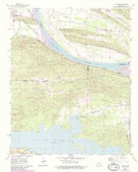
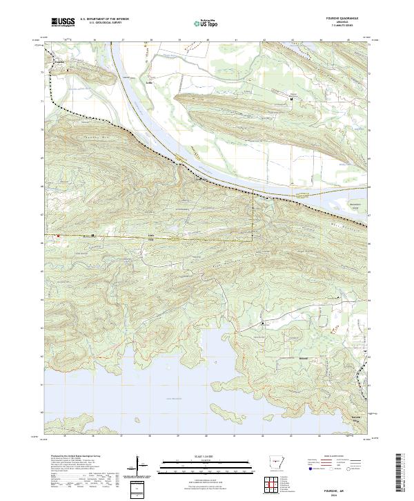
The Arkansas River carves a sweeping path through this landscape, marking the historic boundary where Perry, Faulkner, and Pulaski counties meet. North of the river, the settlement of Lollie sits near the site of the Lawson Ferry, a reminder of the river-crossing era before modern bridge networks dominated the region. The terrain is defined by prominent ridges such as Easterwood Mountain and Kenney Mtn, while the southern portion is dominated by the extensive waters of Lake Maumelle. Smaller communities like Little Italy and Ledwidge are connected by a network of rural roads such as Ross Hollow Rd, which winds through the gap between Kryer Mountain and Moss Mountain. Local history is anchored by numerous burial grounds, including Saint Francis Cem and Rainey Cem, while the distinctively named Natural Steps marks the southeastern corner of the survey near the riverbank.
Find a feature on this map
89 named features on this map. Tap any name to fly to it.
Don’t see what you’re looking for? This feature index may not catch every label — zoom into the map to look around manually.
Map Details
Editions of this 2024 Fourche Map
This is the sole edition of this map. No revisions or reprints were ever made.