2022 Map of Foxhome
USGS Topo · Published 2022About this map
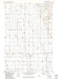
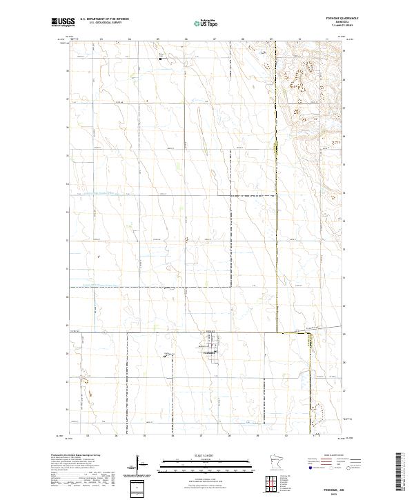
Foxhome sits at the heart of this agricultural landscape in Wilkin County, where a highly organized grid of section lines and township boundaries defines the land use. The terrain is notably marked by an extensive water management system, including County Ditch Number Thirty One and County Ditch Number Three-Two, which speak to the area's transition into productive prairie farmland. For those researching local family histories, the map identifies key burial sites such as Foxhome Cem just south of the town center and Burau Cem situated in the northern sections. The survey details a dense network of local roads and township routes, like Co Rd 19 and Boese Ave, that connect the disparate farmsteads and rural blocks across several townships including t133n r45w and t132n r44w.
Find a feature on this map
57 named features on this map. Tap any name to fly to it.
Don’t see what you’re looking for? This feature index may not catch every label — zoom into the map to look around manually.
Map Details
Editions of this 2022 Foxhome Map
This is the sole edition of this map. No revisions or reprints were ever made.