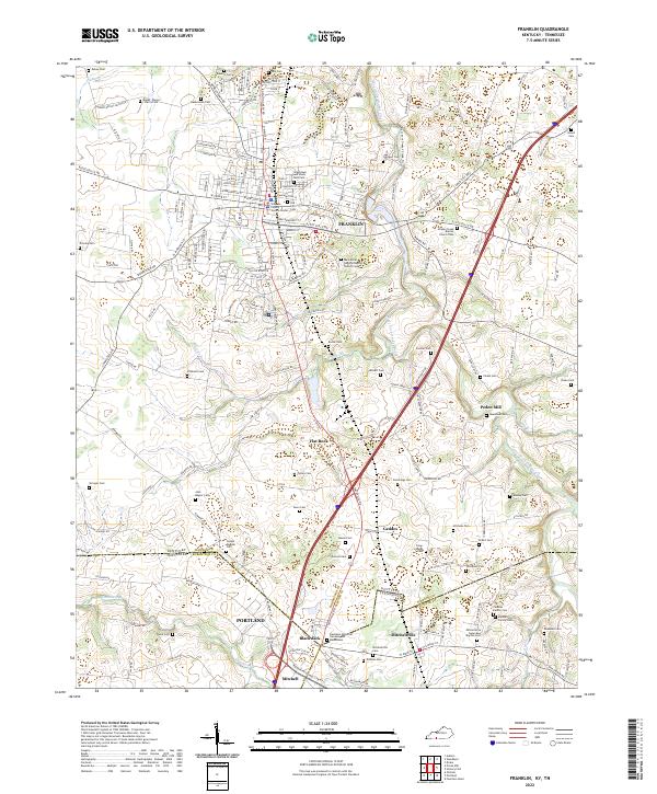
2022 Map of Franklin
USGS Topo · Published 2022About this map
The Simpson County seat of Franklin serves as the central hub of this borderlands survey, where the rolling landscapes of southern Kentucky meet the Tennessee state line. The town's grid is anchored by the Justice Center and historical sites like the Old County Cem, surrounded by residential expansion and industrial corridors such as Nashville Rd. To the south, the terrain becomes a patchwork of family farms and rural communities including Flat Rock, Geddes, and Peden Mill.
Find a feature on this map
193 named features on this map. Tap any name to fly to it.
Don’t see what you’re looking for? This feature index may not catch every label — zoom into the map to look around manually.
Map Details
Editions of this 2022 Franklin Map
This is the sole edition of this map. No revisions or reprints were ever made.
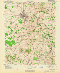
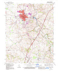
Historical Maps of Flat Rock Through Time
3 maps found