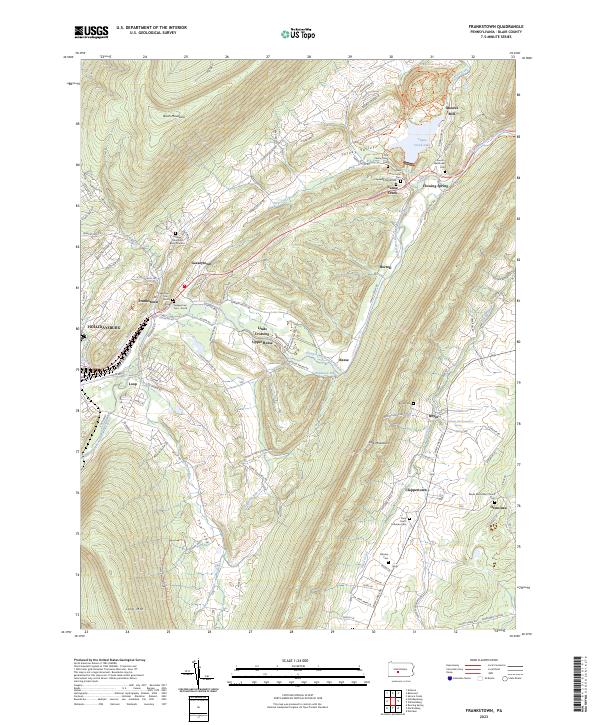
2023 Map of Frankstown
USGS Topo · Published 2023About this map
The Frankstown Branch Juniata River flows through a landscape defined by parallel ridges and narrow valleys, where small settlements like Geeseytown and Frankstown have long stood at the gateway to the mountains. The map reveals a dense concentration of historical burial sites, from the Markey Shinnefelt Burial Ground on the slopes of Brush Mountain to the Geeseytown Cem -North and Geeseytown Cem -South near the village. To the east, the Canoe Creek Lake area and the village of Canoe Creek highlight how water resources have shaped local recreation and infrastructure. Further south, the rural character of the terrain is punctuated by small hamlets and landmarks like Clappertown and the Pennsylvania Fish Commission Spring, while numerous family-named cemeteries such as the Rhodes Cem and Royer Cem provide significant detail for genealogical research in this part of Blair County.
Find a feature on this map
105 named features on this map. Tap any name to fly to it.
Don’t see what you’re looking for? This feature index may not catch every label — zoom into the map to look around manually.
Map Details
Editions of this 2023 Frankstown Map
This is the sole edition of this map. No revisions or reprints were ever made.
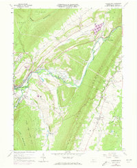
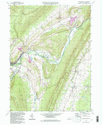
Historical Maps of Flowing Spring Through Time
3 maps found