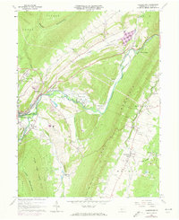
1963 Map of Frankstown
USGS Topo · Published 1978About this map
Frankstown and its surrounding river valley are defined by the convergence of the Frankstown Branch Juniata River and the industrial infrastructure of the early 1960s. The landscape reflects a legacy of extraction and transportation, with numerous quarries, gravel pits, and claypits scattered along the flanks of Brush Mountain and Lock Mountain. The Penn Central railroad tracks parallel the waterway, serving as a primary corridor through a region marked by small settlements like Geeseytown, Reese, and Royer.
Find a feature on this map
48 named features on this map. Tap any name to fly to it.
Don’t see what you’re looking for? This feature index may not catch every label — zoom into the map to look around manually.
Map Details
Editions of this 1963 Frankstown Map
4 editions found
Other maps of this area

1901 · Huntingdon
USGS Topo · 1:62,500

1902 · Hollidaysburg
USGS Topo · 1:62,500

1903 · Hollidaysburg
USGS Topo · 1:62,500

1904 · Huntingdon
USGS Topo · 1:62,500

1920 · Altoona
USGS Topo · 1:62,500

1922 · Altoona
USGS Topo · 1:62,500

1923 · Tyrone
USGS Topo · 1:62,500

1929 · Tyrone
USGS Topo · 1:48,000

1933 · Tyrone
USGS Topo · 1:62,500

1946 · Tyrone
USGS Topo · 1:62,500
Featured Places
- Frankstown Township, PA
- Hollidaysburg, PA
- Upper Reese, Frankstown Township
- Royer, Woodbury Township
- Logan Township, PA