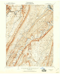
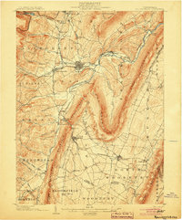
1901 Map of Huntingdon
USGS Topo · Published 1960About this map
The Raystown Branch Juniata River carves a dramatic, winding path through a series of parallel ridges in this turn-of-the-century landscape. The topography is defined by the sharp elevations of Tussey Mountain and Allegrippis Ridge, which forced early settlement into the narrow valleys. Industrial sites like Cove Forge and Franklin Forge suggest the region's early iron heritage, while the P. R. R. line and the Springfield Junc highlight the importance of rail transport for connecting remote communities.
Find a feature on this map
92 named features on this map. Tap any name to fly to it.
Don’t see what you’re looking for? This feature index may not catch every label — zoom into the map to look around manually.
Map Details
Editions of this 1901 Huntingdon Map
This is the sole edition of this map. No revisions or reprints were ever made.
Other maps of this area
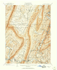
1900 · Everett
USGS Topo · 1:62,500
1902 · Everett
USGS Topo · 1:62,500
1902 · Hollidaysburg
USGS Topo · 1:62,500
1903 · Hollidaysburg
USGS Topo · 1:62,500
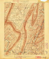
1904 · Huntingdon
USGS Topo · 1:62,500

1919 · Menno
USGS Topo · 1:62,500

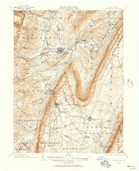
1920 · Altoona
USGS Topo · 1:62,500

1922 · Mt Union
USGS Topo · 1:48,000

1922 · Altoona
USGS Topo · 1:62,500

1923 · Tyrone
USGS Topo · 1:62,500