
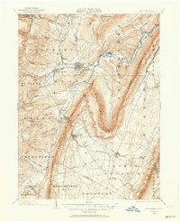
1902 Map of Hollidaysburg
USGS Topo · Published 1957About this map
Hollidaysburg and the surrounding Ridge-and-Valley province of central Pennsylvania are defined by the industry and transit routes of the early twentieth century. The Pennsylvania R. R. weaves through narrow gaps in the terrain, including Blair Gap and the ascent toward Kittanning Pt, while the Frankstown Branch Juniata River provides the primary drainage for numerous runs like Burgoon Run and Sugar Run. The landscape is a corridor of industrial activity, with the Altoona Reservoir supporting the nearby rail hub and Ore Hill marking a legacy of mineral extraction in the southern valleys.
Find a feature on this map
90 named features on this map. Tap any name to fly to it.
Don’t see what you’re looking for? This feature index may not catch every label — zoom into the map to look around manually.
Map Details
Editions of this 1902 Hollidaysburg Map
2 editions found
Other maps of this area

1900 · Everett
USGS Topo · 1:62,500

1901 · Huntingdon
USGS Topo · 1:62,500

1902 · Everett
USGS Topo · 1:62,500

1902 · Ebensburg
USGS Topo · 1:62,500

1902 · Patton
USGS Topo · 1:62,500

1903 · Hollidaysburg
USGS Topo · 1:62,500

1904 · Huntingdon
USGS Topo · 1:62,500

1904 · Patton
USGS Topo · 1:62,500

1904 · Ebensburg
USGS Topo · 1:62,500

1908 · Bedford
USGS Topo · 1:62,500