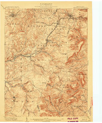
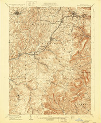
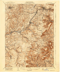
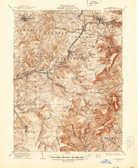
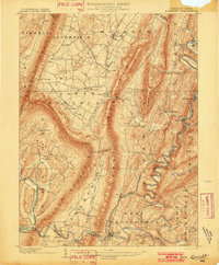
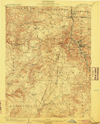
1904 Map of Ebensburg
USGS Topo · Published 1904About this map
Ebensburg and the surrounding coal and rail country of Cambria County are defined here by the heavy industrial infrastructure of the early twentieth century. The Pennsylvania RR dominates the landscape, threading through the high gaps of the Allegheny Front at Gallitzin and Cresson. This rail corridor, including the Pittsburg Division, supported a network of mining and company towns such as Portage, Lilly, and Beaverdale. The map reveals how the steep topography dictated settlement patterns, with towns clustered in the narrow valleys of the Little Conemaugh River and its branches. Elevated landmarks like Blue Knob and the various gaps, including Bobs Creek Gap and Adams Gap, illustrate the natural barriers that the railroads had to navigate. For the researcher, the map preserves the original footprints of numerous small communities like Sonman, Myra, and Puritan, along with rural identifiers like Mt Hope Church.
Find a feature on this map
88 named features on this map. Tap any name to fly to it.
Don’t see what you’re looking for? This feature index may not catch every label — zoom into the map to look around manually.
Map Details
Editions of this 1904 Ebensburg Map
7 editions found
Other maps of this area
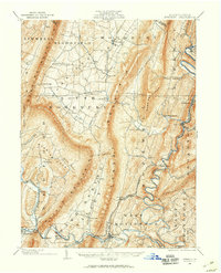
1900 · Everett
USGS Topo · 1:62,500
1902 · Everett
USGS Topo · 1:62,500
1902 · Ebensburg
USGS Topo · 1:62,500

1902 · Patton
USGS Topo · 1:62,500

1902 · Barnesboro
USGS Topo · 1:62,500
1902 · Hollidaysburg
USGS Topo · 1:62,500
1903 · Hollidaysburg
USGS Topo · 1:62,500
1904 · Barnesboro
USGS Topo · 1:62,500

1904 · Patton
USGS Topo · 1:62,500
1904 · Johnstown
USGS Topo · 1:62,500