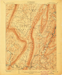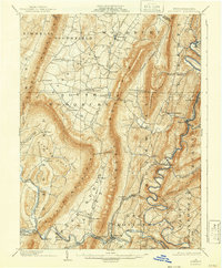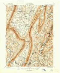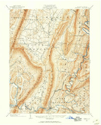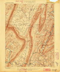
1902 Map of Everett
USGS Topo · Published 1902About this map
Raystown Branch Juniata River snakes through the deep valleys of Bedford County, creating a corridor for the Huntingdon and Broadtop R. R. to connect industrial outposts like Hopewell and Riddlesburg. The landscape is defined by the sharp, parallel ridges of Tussey Mountain and Dunning Mountain, which isolate fertile coves and narrow valleys. This early century survey captures a network of agrarian and industrial settlements, from the agricultural hub of New Enterprise to the localized operations at Valley Mill. Transport is a mix of river-side rail lines and gaps through the ridges, such as those near Loysburg and Everett. Smaller rail spurs like the H. and B. Mtn. R. R. suggest the active mining and timber extraction occurring along Broad Top and Warrior Ridge during this period of Pennsylvania's development.
Find a feature on this map
61 named features on this map. Tap any name to fly to it.
Don’t see what you’re looking for? This feature index may not catch every label — zoom into the map to look around manually.
Map Details
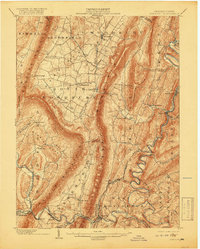
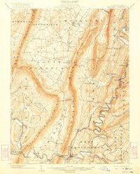
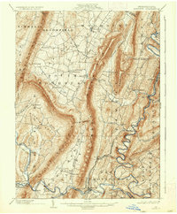
Editions of this 1902 Everett Map
7 editions found