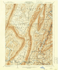
1902 Map of Everett
USGS Topo · Published 1942About this map
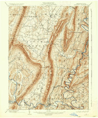
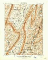
Everett and its surrounding Bedford County townships appear at a crossroads of industry and agriculture at the opening of the twentieth century. The Raystown Branch Juniata River carves a winding path through the eastern half of the map, followed closely by the tracks of the Huntingdon and Broad Top Mountain Railroad. This rail line served riverside communities such as Hopewell, Cypher, and Riddlesburg, connecting the valley's resources to wider markets. To the west, the landscape is defined by the massive ridges of Tussey Mountain and Dunning Mountain, which separate the river valley from fertile pockets like Snake Spring Valley and Dutch Corner. Small settlements like New Enterprise, Loysburg, and Waterside dot the northern valleys, while the Penna RR skirts the southern edge of the mountains, passing through Ashcom and Cliffs. The presence of sites like Valley Mill indicates the localized water-powered industry that sustained these rural communities.
Find a feature on this map
59 named features on this map. Tap any name to fly to it.
Don’t see what you’re looking for? This feature index may not catch every label — zoom into the map to look around manually.
Map Details
Editions of this 1902 Everett Map
7 editions found
Other maps of this area

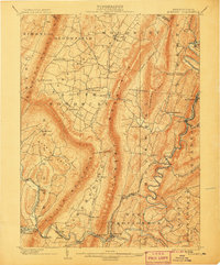
1900 · Everett
USGS Topo · 1:62,500

1901 · Huntingdon
USGS Topo · 1:62,500

1902 · Everett
USGS Topo · 1:62,500

1902 · Ebensburg
USGS Topo · 1:62,500

1902 · Hollidaysburg
USGS Topo · 1:62,500

1903 · Hollidaysburg
USGS Topo · 1:62,500

1904 · Huntingdon
USGS Topo · 1:62,500

1904 · Ebensburg
USGS Topo · 1:62,500

1908 · Bedford
USGS Topo · 1:62,500

1910 · Bedford
USGS Topo · 1:62,500