Loading...
Loading map...1902 Map of Everett
USGS Topo · Published 1907About this map
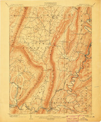
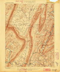
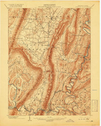
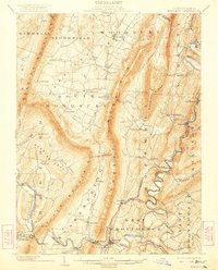
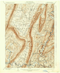
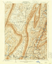
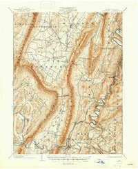
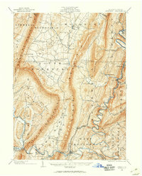
Everett and its surrounding mountain ridges define the landscape of this Central Pennsylvania survey, conducted at the start of the twentieth century. The topography is dominated by the massive parallel lines of Tussey Mountain, Dunning Mountain, and Evitts Mountain, which channel settlement and transportation into narrow valleys. Along the winding Raystown Branch Juniata River, the Huntingdon and Broadtop R. R. serves industrial and passenger needs, connecting river towns like Hopewell and Riddlesburg to the regional rail network.
Find a feature on this map
62 named features on this map. Tap any name to fly to it.
Don’t see what you’re looking for? This feature index may not catch every label — zoom into the map to look around manually.
Map Details
Date Portrayed1902
Date Published1907
PublisherU.S. Geological Survey
Map TypeTopographic
Scale1:62,500
Physical Dimensions16.5 x 19.9 inches
Editions of this 1902 Everett Map
7 editions found
Historical Maps of Bedford Through Time
Featured Locations
Source Details
SourceU.S. Geological Survey
CopyrightPublic Domain