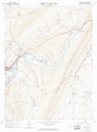
1963 Map of Frankstown
USGS Topo · Published 1973About this map
Frankstown Branch Juniata River flows through a landscape defined by the heavy industry and transit corridors of central Blair County. In the early 1960s, the Penn Central railroad followed the river's winding course, serving industrial sites like the numerous quarries, gravel pits, and claypits scattered across the township. The map documents a cluster of small settlements and named crossings such as Geeseytown, Linda Crossing, and Upper Reese, reflecting a community tied to the land and the rail lines.
Find a feature on this map
51 named features on this map. Tap any name to fly to it.
Don’t see what you’re looking for? This feature index may not catch every label — zoom into the map to look around manually.
Map Details
Editions of this 1963 Frankstown Map
4 editions found
Other maps of this area

1901 · Huntingdon
USGS Topo · 1:62,500

1902 · Hollidaysburg
USGS Topo · 1:62,500

1903 · Hollidaysburg
USGS Topo · 1:62,500

1904 · Huntingdon
USGS Topo · 1:62,500

1920 · Altoona
USGS Topo · 1:62,500

1922 · Altoona
USGS Topo · 1:62,500

1923 · Tyrone
USGS Topo · 1:62,500

1929 · Tyrone
USGS Topo · 1:48,000

1933 · Tyrone
USGS Topo · 1:62,500

1946 · Tyrone
USGS Topo · 1:62,500
Featured Places
- Frankstown Township, PA
- Hollidaysburg, PA
- Upper Reese, Frankstown Township
- Royer, Woodbury Township
- Logan Township, PA