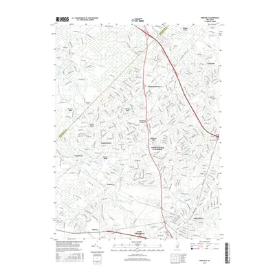
2016 Map of Freehold
USGS Topo · Published 2016About this map
Freehold and the surrounding Monmouth County countryside are shown here during a period of dense suburban infill, where modern residential developments like Monmouth Heights at Manalapan sit alongside much older village sites. The landscape is defined by the headwaters of several significant waterways, including Manalapan Brook and Matchaponix Brook, which historically powered local industry. The map illustrates the shift from a rural agricultural economy toward a regional residential hub, with historical milling sites such as Lafayette Mills and Mounts Mills now surrounded by neighborhood streets.
Find a feature on this map
53 named features on this map. Tap any name to fly to it.
Don’t see what you’re looking for? This feature index may not catch every label — zoom into the map to look around manually.
Map Details
Editions of this 2016 Freehold Map
This is the sole edition of this map. No revisions or reprints were ever made.
Other maps of this area

1888 · New Brunswick
USGS Topo · 1:62,500

1888 · Asbury Park
USGS Topo · 1:62,500

1888 · Cassville
USGS Topo · 1:62,500

1888 · Sandy Hook
USGS Topo · 1:62,500

1893 · New Brunswick
USGS Topo · 1:62,500

1893 · Sandy Hook
USGS Topo · 1:62,500

1893 · Asbury Park
USGS Topo · 1:62,500

1894 · Cassville
USGS Topo · 1:62,500

1900 · Cassville
USGS Topo · 1:62,500

1901 · New Brunswick
USGS Topo · 1:62,500
Featured Places
- Old Bridge Township, NJ
- Monroe Township, NJ
- Marlboro Township, NJ
- Manalapan Township, NJ
- Freehold Township, NJ