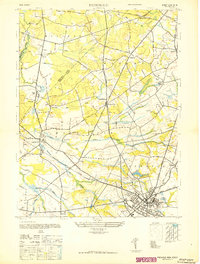
1947 Map of Freehold
USGS Topo · Published 1947About this map
The Monmouth County landscape documented in this 1940s-era survey reveals a transition between rural agricultural crossroads and the growing borough of Freehold. The area is characterized by numerous small settlements and water-powered history, evident in family-named landmarks such as Lafayette Mills, Taylors Mills, and Mounts Mills. At the heart of the township, the Old Tennent Ch stands near the Pennsylvania Railroad (Freehold Branch), marking a site of deep local significance dating back to the Revolutionary era. The rail network, including the Central Railroad of New Jersey, anchors the local economy, connecting smaller hamlets like Tennent and Englishtown to the larger regional trade routes. Further south, the early aviation presence is noted at the Asbury Park Airport, while several brooks, including Matchaponix Brook and Tepehemus Brook, define the drainage patterns of this fertile coastal plain before the massive post-war residential expansion reshaped the county.
Find a feature on this map
47 named features on this map. Tap any name to fly to it.
Don’t see what you’re looking for? This feature index may not catch every label — zoom into the map to look around manually.
Map Details
Editions of this 1947 Freehold Map
This is the sole edition of this map. No revisions or reprints were ever made.
Other maps of this area

1888 · New Brunswick
USGS Topo · 1:62,500

1888 · Asbury Park
USGS Topo · 1:62,500

1888 · Cassville
USGS Topo · 1:62,500

1888 · Sandy Hook
USGS Topo · 1:62,500

1893 · New Brunswick
USGS Topo · 1:62,500

1893 · Sandy Hook
USGS Topo · 1:62,500

1893 · Asbury Park
USGS Topo · 1:62,500

1894 · Cassville
USGS Topo · 1:62,500

1900 · Cassville
USGS Topo · 1:62,500

1901 · New Brunswick
USGS Topo · 1:62,500
Featured Places
- Old Bridge Township, NJ
- Monroe Township, NJ
- Marlboro Township, NJ
- Manalapan Township, NJ
- Freehold Township, NJ