
Loading...
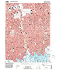
Loading map...2023 Map of Freeport
USGS Topo · Published 2023About this map
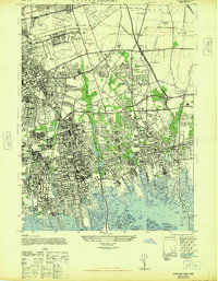
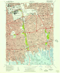
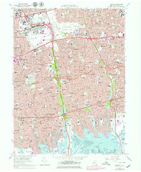
The salt marshes and coastal inlets of southern Nassau County define this modern landscape, where developed residential grids of Freeport, Merrick, and Wantagh meet the complex wetlands of Hempstead Bay. The map details a densely populated suburban corridor shaped by major transportation arteries, including the Southern State Pkwy and the Long Island RR, which connect historic communities like Hempstead and Levittown.
Find a feature on this map
84 named features on this map. Tap any name to fly to it.
Don’t see what you’re looking for? This feature index may not catch every label — zoom into the map to look around manually.
Map Details
Date Portrayed2023
Date Published2023
PublisherU.S. Geological Survey
Map TypeTopographic
Scale1:24000
Physical Dimensions24 x 29 inches
Editions of this 2023 Freeport Map
This is the sole edition of this map. No revisions or reprints were ever made.
Historical Maps of Bethpage Through Time
5 maps found
Featured Locations
Source Details
SourceU.S. Geological Survey
CopyrightPublic Domain