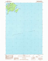
1983 Map of Frenchboro
USGS Topo · Published 1983About this map
Frenchboro stands as the primary settlement on this maritime sheet, situated on the northern end of Long Island where it overlooks the protected waters of Lunt Harbor. The 1983 survey illustrates a landscape deeply connected to the coast, with the town's small street grid and a local Cem serving as the hub for the surrounding island community. Beyond the village, the terrain rises toward Bluff Head and extends south to the narrow protrusion of Richs Head, which is bracketed by Eastern Cove and Western Cove.
Find a feature on this map
28 named features on this map. Tap any name to fly to it.
Don’t see what you’re looking for? This feature index may not catch every label — zoom into the map to look around manually.
Map Details
Editions of this 1983 Frenchboro Map
This is the sole edition of this map. No revisions or reprints were ever made.
Other maps of this area

1904 · Swan Island
USGS Topo · 1:62,500

1943 · Swans Island
USGS Topo · 1:62,500

1945 · Swans Island
USGS Topo · 1:62,500

1948 · Bangor
USGS Topo · 1:250,000

1948 · Bath
USGS Topo · 1:250,000

1956 · Bangor
USGS Topo · 1:250,000

1956 · Bath
USGS Topo · 1:250,000

1957 · Bath
USGS Topo · 1:250,000

1958 · Bath
USGS Topo · 1:250,000

1960 · Bangor
USGS Topo · 1:250,000