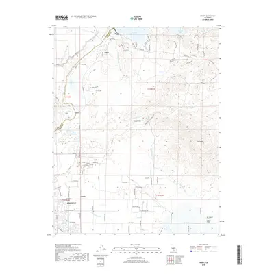
2018 Map of Friant
USGS Topo · Published 2018About this map
The San Joaquin River defines the landscape as it flows through the valley near Friant, marking the northern boundary of this central California region. This 2018 survey documents a complex network of water management infrastructure essential to the Central Valley, including the Madera Canal and the massive Friant-Kern Canal which branches south from the base of Millerton Lake. The elevation transitions from the flat valley floor near Gordon and northern Fresno to the rising foothills of the Sierra Nevada, dominated by the prominent summit of Owens Mtn. Local history is anchored by sites like the Winchell Cove Cem and the recreational areas surrounding Lost Lake. The map illustrates the suburban expansion of Clovis and Fresno as they meet the agricultural and hydroelectric resources of the river corridor, providing a clear record of contemporary infrastructure like the Pontoon Bridge and numerous residential developments along Sky Harbour Rd.
Find a feature on this map
89 named features on this map. Tap any name to fly to it.
Don’t see what you’re looking for? This feature index may not catch every label — zoom into the map to look around manually.
Map Details
Editions of this 2018 Friant Map
This is the sole edition of this map. No revisions or reprints were ever made.
Other maps of this area

1912 · Mariposa
USGS Topo · 1:125,000

1916 · Sulphur Springs
USGS Topo · 1:24,000

1919 · Sulphur Springs
USGS Topo · 1:31,680

1919 · Little Table Mountain
USGS Topo · 1:31,680

1921 · Bullard
USGS Topo · 1:31,680

1922 · Round Mountain
USGS Topo · 1:31,680

1922 · Lanes Bridge
USGS Topo · 1:31,680

1922 · Friant
USGS Topo · 1:31,680

1923 · Academy
USGS Topo · 1:31,680

1923 · Clovis
USGS Topo · 1:31,680