Loading...
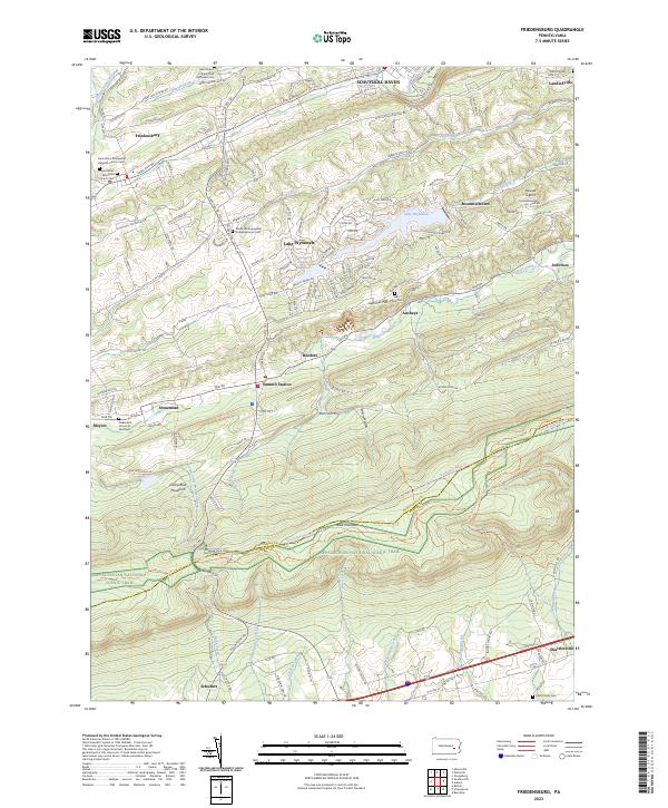
Loading map...2023 Map of Friedensburg
USGS Topo · Published 2023About this map
Friedensburg and Summit Station anchor this rural landscape in central Pennsylvania, where the terrain transitions across the ridges of Schuylkill Mountain and Blue Mountain. For genealogists and local historians, the area is notably dense with denominational burial grounds, including the Saint Peter's Lutheran and Reformed Cem, Saint John's Evangelical Lutheran Church Cem, and the Feick Family Cem near the southern border.
Find a feature on this map
56 named features on this map. Tap any name to fly to it.
Don’t see what you’re looking for? This feature index may not catch every label — zoom into the map to look around manually.
Map Details
Date Portrayed2023
Date Published2023
PublisherU.S. Geological Survey
Map TypeTopographic
Scale1:24000
Physical Dimensions24 x 29 inches
Editions of this 2023 Friedensburg Map
This is the sole edition of this map. No revisions or reprints were ever made.
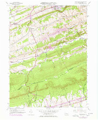
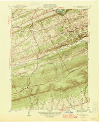
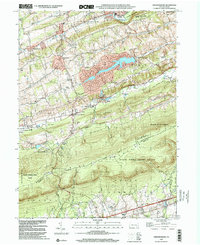
Historical Maps of Upper Bern Township Through Time
4 maps found
Featured Locations
- Bethel Township, PA
- Upper Tulpehocken Township, PA
- South Manheim Township, PA
- Washington Township, PA
- Friedensburg, Wayne Township
Source Details
SourceU.S. Geological Survey
CopyrightPublic Domain