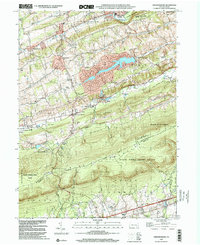
1999 Map of Friedensburg
USGS Topo · Published 2001About this map
Friedensburg and its surrounding townships of North Manheim, South Manheim, and Wayne are defined by the striking ridge of Blue Mountain at the close of the twentieth century. The landscape reveals a legacy of local education and community through several named school sites, including Panther Valley Sch, Deibert Sch, and De Binder Sch. To the south, the Appalachian National Scenic Trail traverses the high ground of the ridge, marking a boundary between Schuylkill and Berks counties. The presence of an Old Railroad Grade near Moyers and Stonemont indicates the historical transportation routes that once linked these valley settlements. This area serves as a significant conservation corridor, protected by extensive tracts of State Game Lands No 110 and the Weiser State Forest, while the Schuylkill River flows through the northern reaches near Cressona.
Find a feature on this map
42 named features on this map. Tap any name to fly to it.
Don’t see what you’re looking for? This feature index may not catch every label — zoom into the map to look around manually.
Map Details
Editions of this 1999 Friedensburg Map
This is the sole edition of this map. No revisions or reprints were ever made.
Other maps of this area

1889 · Pottsville
USGS Topo · 1:62,500

1891 · Pottsville
USGS Topo · 1:62,500

1891 · Lebanon
USGS Topo · 1:62,500

1892 · Pine Grove
USGS Topo · 1:62,500

1893 · Lebanon
USGS Topo · 1:62,500

1899 · Lebanon
USGS Topo · 1:62,500

1902 · Wernersville
USGS Topo · 1:62,500

1943 · Lebanon
USGS Topo · 1:62,500

1943 · Wernersville
USGS Topo · 1:62,500

1944 · Pottsville
USGS Topo · 1:24,000
Featured Places
- Bethel Township, PA
- Friedensburg, Wayne Township
- North Manheim Township, PA
- Summit Station, Wayne Township
- Reedsville, Wayne Township