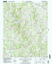
2022 Map of Frog Pond
USGS Topo · Published 2022About this map
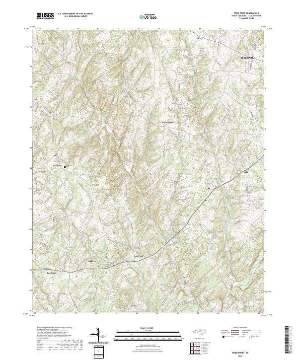
Oakboro and Red Cross anchor the southwestern corner of this modern topographic survey, which illustrates the transition from the edge of Albemarle into the drainage basins of the Rocky River. The landscape is defined by the winding paths of Big Bear Creek and Little Bear Cr, which dictate the network of rural roads such as Frog Pond Rd and Pole Running Rd. Small settlements like Frog Pond, Bloomington, and Plyer are scattered across the terrain, reflecting the dispersed residential and agricultural character of Stanly County.
Find a feature on this map
108 named features on this map. Tap any name to fly to it.
Don’t see what you’re looking for? This feature index may not catch every label — zoom into the map to look around manually.
Map Details
Editions of this 2022 Frog Pond Map
This is the sole edition of this map. No revisions or reprints were ever made.
Historical Maps of Bloomington Through Time
5 maps found