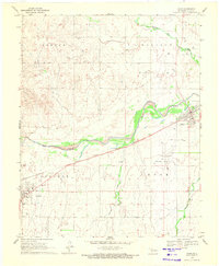
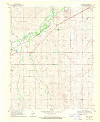
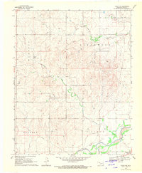
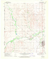
1969 Map of Gage
USGS Topo · Published 1971About this map
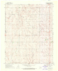
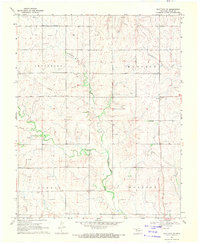
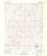
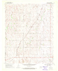
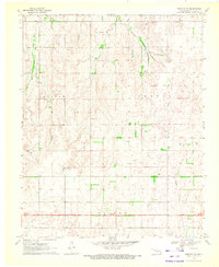
Gage and Shattuck anchor this Ellis County landscape, situated along the vital transport artery of the Atchison Topeka and Santa Fe railroad. The terrain is characterized by a series of drainages, most notably Wolf Creek, which meanders eastward through the center of the sheet, joined by tributaries like Willow Creek and Twentyfive Mile Creek. This 1960s survey illustrates a region where local industry and transportation infrastructure are closely linked to the geography, with multiple Caliche Pits and a Sandpit scattered across the township sections.
Find a feature on this map
16 named features on this map. Tap any name to fly to it.
Don’t see what you’re looking for? This feature index may not catch every label — zoom into the map to look around manually.
Map Details
Editions of this 1969 Gage Map
This is the sole edition of this map. No revisions or reprints were ever made.
Other maps of this area

1955 · Woodward
USGS Topo · 1:250,000

1958 · Woodward
USGS Topo · 1:250,000
1969 · Fargo SW
USGS Topo · 1:24,000
1969 · Fargo NW
USGS Topo · 1:24,000
1969 · Shattuck
USGS Topo · 1:24,000
1969 · Shattuck NW
USGS Topo · 1:24,000
1969 · Shattuck NE
USGS Topo · 1:24,000
1970 · Arnett
USGS Topo · 1:24,000
1970 · Goodwin
USGS Topo · 1:24,000
1970 · Harmon NW
USGS Topo · 1:24,000