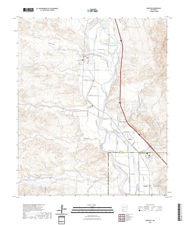
2023 Map of Garfield
USGS Topo · Published 2023About this map
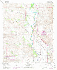
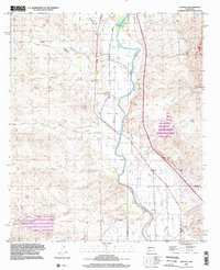
The Rio Grande corridor in southern New Mexico serves as the central artery for a complex network of irrigation that sustains the settlements of Arrey, Derry, and Garfield. This landscape is defined by the intricate engineering of the Arrey Canal, Percha Lateral, and Garfield Canal, which draw water from the river to support the agricultural economy near the Sierra and Doña Ana county line. Local history is deeply embedded in the terrain, with family and community legacy marked at the Arrey Catholic Cem, Garfield Cem Old, and the Arrey Community Church Cem. To the west, the land rises into the desert breaks of Trujillo Canyon and Sibley Canyon, where ephemeral drainages like Tierra-Blanca Creek and Montoya Arroyo carve through the arid geography toward the fertile valley floor.
Find a feature on this map
73 named features on this map. Tap any name to fly to it.
Don’t see what you’re looking for? This feature index may not catch every label — zoom into the map to look around manually.
Map Details
Editions of this 2023 Garfield Map
This is the sole edition of this map. No revisions or reprints were ever made.
Historical Maps of Arrey Through Time
3 maps found