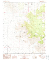
1989 Map of Garnet Mountain
USGS Topo · Published 1990About this map
Grapevine Mesa dominates the northern landscape of this Mohave County region, where the high desert terrain transitions toward the Hualapai Valley in the southwest. The area's reliance on scarce water sources is evident through a network of named springs and improved water points, including Valley Ranch Spring, Garnet Spring, and Rattlesnake Spring. Human activity is concentrated around modest outposts like Valley Ranch and the Ray Place, with transportation corridors such as Pearce Ferry Road and Antares Road cutting across the desert floor.
Find a feature on this map
26 named features on this map. Tap any name to fly to it.
Don’t see what you’re looking for? This feature index may not catch every label — zoom into the map to look around manually.
Map Details
Editions of this 1989 Garnet Mountain Map
This is the sole edition of this map. No revisions or reprints were ever made.
Other maps of this area

1886 · Diamond Creek
USGS Topo · 1:250,000

1886 · Camp Mohave
USGS Topo · 1:250,000

1892 · Diamond Creek
USGS Topo · 1:250,000

1892 · Camp Mohave
USGS Topo · 1:250,000

1942 · Camp Mohave
USGS Topo · 1:250,000

1947 · Kingman
USGS Topo · 1:250,000

1948 · Kingman
USGS Topo · 1:250,000

1948 · Williams
USGS Topo · 1:250,000

1954 · Kingman
USGS Topo · 1:250,000

1954 · Williams
USGS Topo · 1:250,000