
1948 Map of Williams
USGS Topo · Published 1948About this map
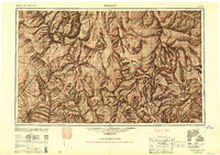
The Atchison Topeka and Santa Fe railroad serves as the primary corridor through this Northern Arizona landscape, paralleled by the iconic Route 66. This transit network connects several high-desert and mountain settlements, including the western hub of Kingman and the rail town of Seligman. The map documents a complex overlay of administrative boundaries and federal lands, from the Hualpai Indian Reservation to the protected reaches of the Kaibab National Forest and Prescott National Forest. To the north, the terrain drops toward the Grand Canyon and the eastern arm of Lake Mead within the Boulder Dam Recreational Area. This 1948 compilation provides a detailed view of the regional infrastructure as it stood just after the Second World War, showing the relationship between early highway travel and the established mountain towns of Williams and Ashfork.
Find a feature on this map
40 named features on this map. Tap any name to fly to it.
Don’t see what you’re looking for? This feature index may not catch every label — zoom into the map to look around manually.
Map Details
Editions of this 1948 Williams Map
2 editions found
Other maps of this area

1886 · Diamond Creek
USGS Topo · 1:250,000

1886 · Camp Mohave
USGS Topo · 1:250,000

1886 · Saint Thomas
USGS Topo · 1:250,000

1886 · San Francisco Mtns
USGS Topo · 1:250,000

1886 · Mt. Trumbull
USGS Topo · 1:250,000

1886 · Chino
USGS Topo · 1:250,000

1886 · Echo Cliffs
USGS Topo · 1:250,000

1886 · Kaibab
USGS Topo · 1:250,000

1887 · Verde
USGS Topo · 1:250,000

1887 · Prescott
USGS Topo · 1:250,000