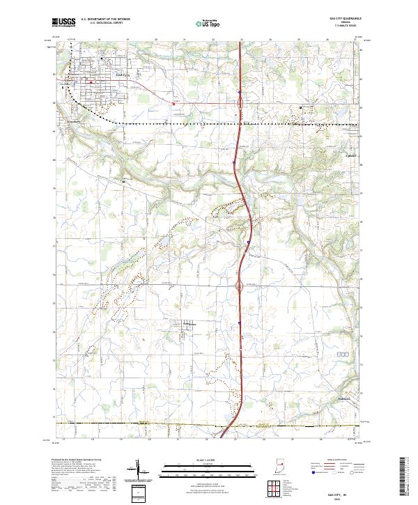
2022 Map of Gas City
USGS Topo · Published 2022About this map
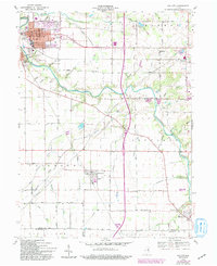
The Mississinewa River winds through this central Indiana landscape, anchoring a corridor of historic settlements from Gas City and Jonesboro in the northwest to Matthews in the southeast. The terrain is defined by a dense network of watercourses and agricultural drainage, including Barren Cr, Galatia Ditch, and Fowler Ditch, which reflect the region's managed hydrology. Rural life is punctuated by smaller hubs like Fowlerton and Upland, with established local history marked by several burial grounds such as Walnut Creek Cem, Riverside Cem, and Bethel Cem. Transportation patterns are dominated by the Wheeling Pike and the modern interstate corridor, which together cut across traditional township lines. This survey captures the steady layout of the Grant, Madison, and Delaware county borders, where family farms and small communities maintain a grid-based settlement pattern first established in the nineteenth century.
Find a feature on this map
92 named features on this map. Tap any name to fly to it.
Don’t see what you’re looking for? This feature index may not catch every label — zoom into the map to look around manually.
Map Details
Editions of this 2022 Gas City Map
This is the sole edition of this map. No revisions or reprints were ever made.