2022 Map of Gibsonville
USGS Topo · Published 2022About this map
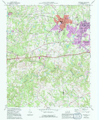
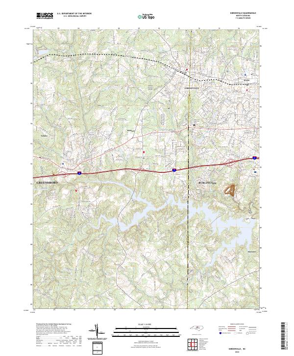
Gibsonville and Whitsett anchor this detailed landscape along the Guilford Co and Alamance Co border in North Carolina. The map captures the suburban and institutional character of the region, featuring the campus of Elon University in the northeast and the residential expansion around Elon and Burlington. The terrain is defined by a dense network of waterways, including the winding Little Alamance Creek and Big Alamance Cr, which flow through an area increasingly shaped by transportation infrastructure. Modern corridors like Interstate 40 85 and Burlington Rd slice through the Piedmont landscape, connecting these historic towns to the nearby city of Greensboro. From the local aviation history at McLean Brothers Airport to the quiet memorial grounds of Alamance Memorial Park, the map illustrates a transition from small-town railroad roots to a modern educational and transit hub.
Find a feature on this map
200 named features on this map. Tap any name to fly to it.
Don’t see what you’re looking for? This feature index may not catch every label — zoom into the map to look around manually.
Map Details
Editions of this 2022 Gibsonville Map
This is the sole edition of this map. No revisions or reprints were ever made.