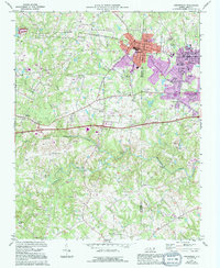
1970 Map of Gibsonville
USGS Topo · Published 1994About this map
Gibsonville and Elon College stand as the primary population centers on this 1970 map, straddling the Guilford Co and Alamance Co border. The landscape is defined by the headwaters and tributaries of Big Alamance Creek, with smaller communities like Whitsett and Sedalia connected by a network of rural roads and rail lines. Modern updates from 1994 show the expanding footprint of residential development around the western edge of Burlington and the growth of the local college campus.
Find a feature on this map
35 named features on this map. Tap any name to fly to it.
Don’t see what you’re looking for? This feature index may not catch every label — zoom into the map to look around manually.
Map Details
Editions of this 1970 Gibsonville Map
2 editions found

Other maps of this area

1951 · Browns Summit
USGS Topo · 1:24,000

1952 · Mc Leansville
USGS Topo · 1:24,000

1953 · Raleigh
USGS Topo · 1:250,000

1953 · Greensboro
USGS Topo · 1:250,000

1954 · Greensboro
USGS Topo · 1:250,000

1954 · Raleigh
USGS Topo · 1:250,000

1962 · Greensboro
USGS Topo · 1:250,000

1966 · Greensboro
USGS Topo · 1:250,000

1969 · Burlington
USGS Topo · 1:24,000

1969 · Lake Burlington
USGS Topo · 1:24,000