
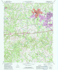
1970 Map of Gibsonville
USGS Topo · Published 1973About this map
The Guilford Co Alamance Co border bisects the landscape of this 1970 survey, centered on the growing towns of Gibsonville and Elon College. The Southern railroad serves as the primary East-West transit corridor, connecting these communities and facilitating local industry, including a Quarry and Gravel Pit to the west. The rural areas between Whitsett and Sedalia are defined by a network of waterways such as Big Alamance Creek, Back Creek, and Rock Creek, which shape the rolling agricultural terrain.
Find a feature on this map
31 named features on this map. Tap any name to fly to it.
Don’t see what you’re looking for? This feature index may not catch every label — zoom into the map to look around manually.
Map Details
Editions of this 1970 Gibsonville Map
2 editions found
Other maps of this area

1951 · Browns Summit
USGS Topo · 1:24,000

1952 · Mc Leansville
USGS Topo · 1:24,000

1953 · Raleigh
USGS Topo · 1:250,000

1953 · Greensboro
USGS Topo · 1:250,000

1954 · Greensboro
USGS Topo · 1:250,000

1954 · Raleigh
USGS Topo · 1:250,000

1962 · Greensboro
USGS Topo · 1:250,000

1966 · Greensboro
USGS Topo · 1:250,000

1969 · Burlington
USGS Topo · 1:24,000

1969 · Lake Burlington
USGS Topo · 1:24,000