
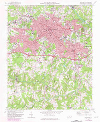
1969 Map of Burlington
USGS Topo · Published 1972About this map
The Haw River flows along the eastern edge of this landscape, framing the mid-century urban expansion of Burlington and Graham. The map captures a significant period of institutional growth in Alamance County, shown through the development of the Technical Institute of Alamance and a dense network of educational facilities such as Turrentine Jr High Sch and Williams High Sch. To the west, Elon College and Glen Raven represent distinct hubs of activity, while the southern reaches remain more rural, characterized by winding watercourses like Big Alamance Creek and Stinking Quarter Creek. This survey provides detailed documentation of the area's social infrastructure, including several family and municipal landmarks like Pine Hill Cemetery, Magnolia Cem, and the County Home, offering a clear look at the region's mid-twentieth-century civic and residential footprint.
Find a feature on this map
58 named features on this map. Tap any name to fly to it.
Don’t see what you’re looking for? This feature index may not catch every label — zoom into the map to look around manually.
Map Details
Editions of this 1969 Burlington Map
2 editions found
Other maps of this area

1953 · Raleigh
USGS Topo · 1:250,000

1953 · Greensboro
USGS Topo · 1:250,000

1954 · Greensboro
USGS Topo · 1:250,000

1954 · Raleigh
USGS Topo · 1:250,000

1962 · Greensboro
USGS Topo · 1:250,000

1966 · Greensboro
USGS Topo · 1:250,000

1969 · Mebane
USGS Topo · 1:24,000

1969 · Lake Burlington
USGS Topo · 1:24,000

1969 · Burlington NE
USGS Topo · 1:24,000

1970 · Gibsonville
USGS Topo · 1:24,000