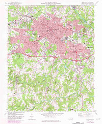
1969 Map of Burlington
USGS Topo · Published 1982About this map
The industrial and academic hub of Alamance County is captured here during a period of significant expansion, centered on the urban core of Burlington and the neighboring seat of Graham. To the west, the campus of Elon College stands as a focal point of the community, while the Southern railroad corridor dictates the path of development between Glen Raven and Riverdale. This survey, updated with 1980s data, illustrates the transition from traditional mill village patterns toward modern suburban growth.
Find a feature on this map
64 named features on this map. Tap any name to fly to it.
Don’t see what you’re looking for? This feature index may not catch every label — zoom into the map to look around manually.
Map Details
Editions of this 1969 Burlington Map
2 editions found
Other maps of this area

1953 · Raleigh
USGS Topo · 1:250,000

1953 · Greensboro
USGS Topo · 1:250,000

1954 · Greensboro
USGS Topo · 1:250,000

1954 · Raleigh
USGS Topo · 1:250,000

1962 · Greensboro
USGS Topo · 1:250,000

1966 · Greensboro
USGS Topo · 1:250,000

1969 · Burlington
USGS Topo · 1:24,000

1969 · Mebane
USGS Topo · 1:24,000

1969 · Lake Burlington
USGS Topo · 1:24,000

1969 · Burlington NE
USGS Topo · 1:24,000